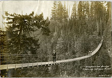
Capilano River
River in British Columbia, CanadaThe Capilano River flows from north to south through the Coast Mountains on the North Shore of the Burrard Inlet between British Columbia's district municipalities of West Vancouver and North Vancouver and empties into Burrard Inlet, opposite Stanley Park. The river is one of three primary sources of drinking water for residents of Greater Vancouver, and flows through the Capilano watershed. The Cleveland Dam, built in 1954, impounds a reservoir for this purpose. The entire area of the reservoir and watershed area upstream of the dam is closed to the public to ensure the quality of the drinking water. Prior to construction of the Cleveland Dam, the Capilano River deposited large amounts of sediment into Burrard Inlet. A dredge was needed to remove this sediment build-up in order to keep Burrard Inlet open for ship traffic.


